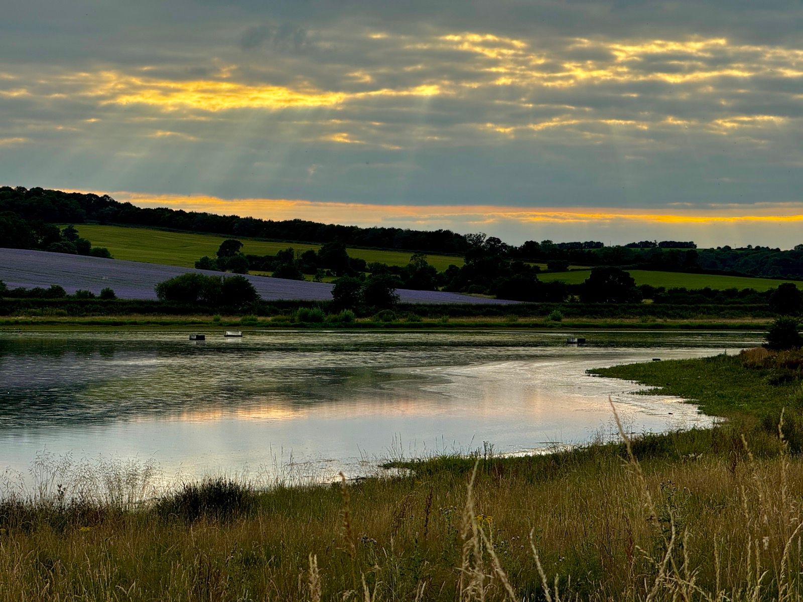
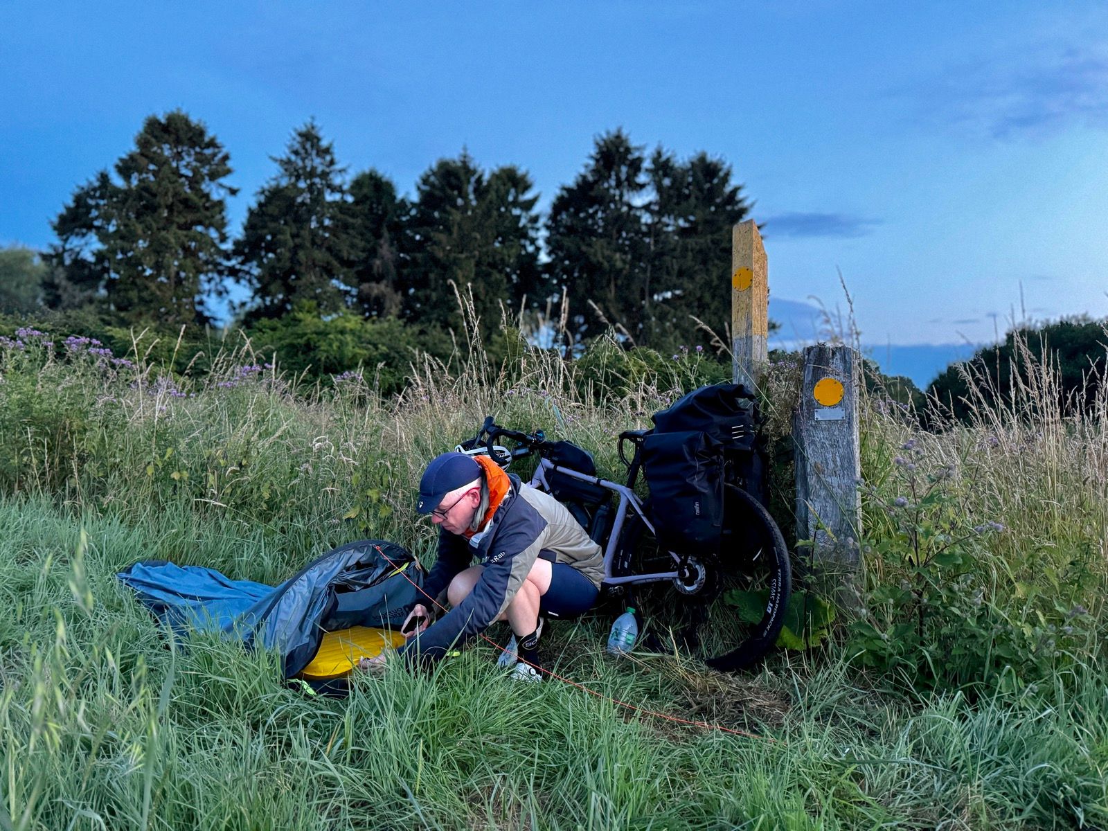
Seeking a scenic bivvying spot I used my OS maps app to find a likely location: just beyond Stoke Dry. The location had a bridleway well away from any houses and sloping ground with a view down to a reservoir and a bridleway. I had my plan.
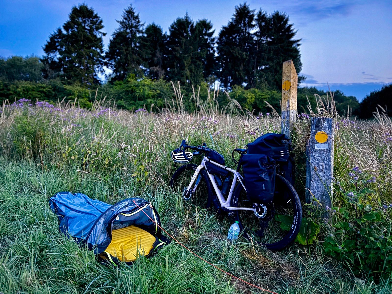
Turned out to be a great plan. The view was sweet and the bridleway took me through deep overgrowth so I was unlikely to be disturbed.
I don’t ever seek permission to wild camp. I leave no trace and, as it’s a bivvying set up, I’m not even in a tent but sleeping besides my bike, hobo-style.
The reservoir was built in 1937 to supply water to the Corby steelworks a few miles distant. In 1943 it was one of the bodies of water used as practice by the Dambusters squadron. Uppingham reservoir as it was then known substituted for the Mohne dam and the Lancasters would fly over it at night on dummy runs, banking right at the dam end and only just clearing Stoke Dry’s church.
I researched this history while tucking into a tuna sandwich bought from an Uppingham convenience store. (I don’t carry cooking equipment when camping.)
My end-of-day routine now also involves buying a pint of milk into which I shake some Veloforte post-exercise protein powder as well as extra collagen powder to stave off problems with what can be a dodgy right knee.
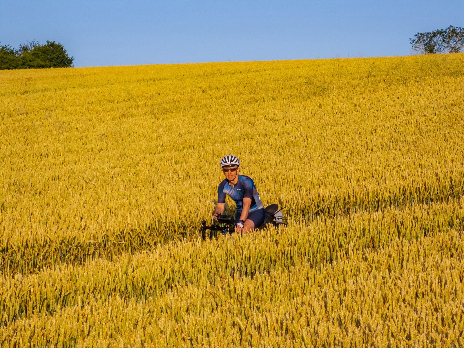
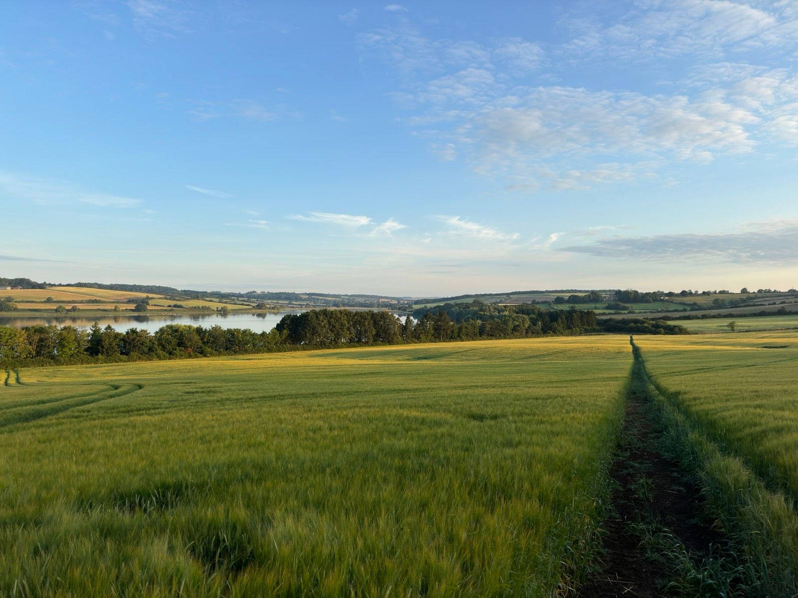
I flew the drone over the fields next to the reservoir (at about the height the Lancasters flew over but SSI rules say I can’t fly my drone over today) and then settled down for a short night. I was up and away by 5am, but before I got to a road I stopped to take drone shots of the wheat field I’d slept beside. The farmer had cut a wide swathe through the field, marking out the right of way.
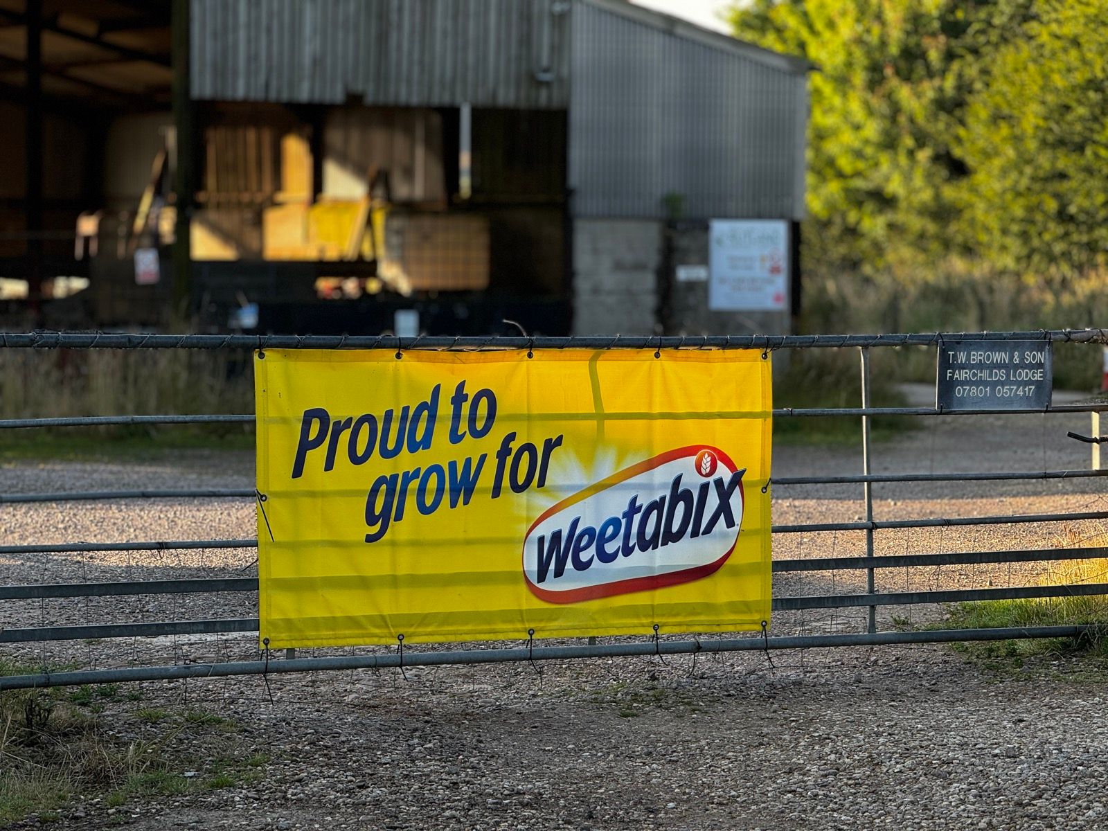
Further on, a sign said that farm was a proud supplier to Weetabix.
Maybe that’s the farm that works the field I slept in?
If so, I seek the farmer’s forgiveness.

0 Comments